Community Engagement Workshop
WELCOME
In this section, I showcase my community engagement and participatory mapping projects. These include a campus walkability study with Texas Tech University students, where participants documented their walking experiences through digital and manual mapping, and the Social Mapcrafta workshop with Harmony Science Academy middle school students, where youth explored their neighborhoods through creative mapping and storytelling.
Both projects emphasize participatory methods, student involvement, and community voice, reflecting my commitment to engaged scholarship and inclusive urban research.
Social Mapcrafta
 |  |
|---|---|
 |  |
 |  |
 |  |
 |  |
 |  |
 |  |
 |
Fall 2024 |
A Mapping Co-Creation Series to Advance Geography Education with Harmony Science Academy – Lubbock
Community: Hispanic and Latinx middle school students
I co-led this workshop with an orientation session at Harmony Science Academy–Lubbock, where students were introduced to the goals of the activity and prepared for field observation. They then participated in a walking diary and observational walk through two contrasting neighborhoods—North Overton, a redeveloped district, and South Overton, known for its preserved historic homes. Along the way, students documented features such as trees, campus spaces, local history, and everyday destinations like stores and food places.
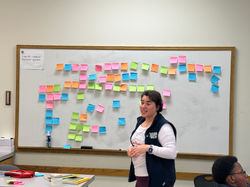
Back at the Geography Department at Texas Tech University, students engaged in a collage exercise. Using images cut from journals, they created collages to represent their perceptions of Lubbock. Each student then shared a short narrative about their collage with a peer partner, while the partner listened carefully and recorded key words on sticky notes. As a group, we collected these sticky notes on a shared whiteboard, building a collective vocabulary of place-based perceptions.
Interestingly, although many students began the day by saying “Lubbock is not fun,” the walking and collage activities revealed more nuanced and positive perspectives. Through embodied exploration and creative expression, students recognized fun and meaningful elements in their environment—such as trees, campus landmarks, and community spaces—that shaped a richer sense of place.
Community-Engaged Research & Design


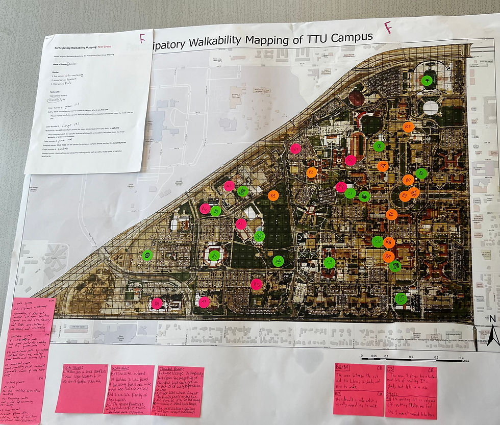
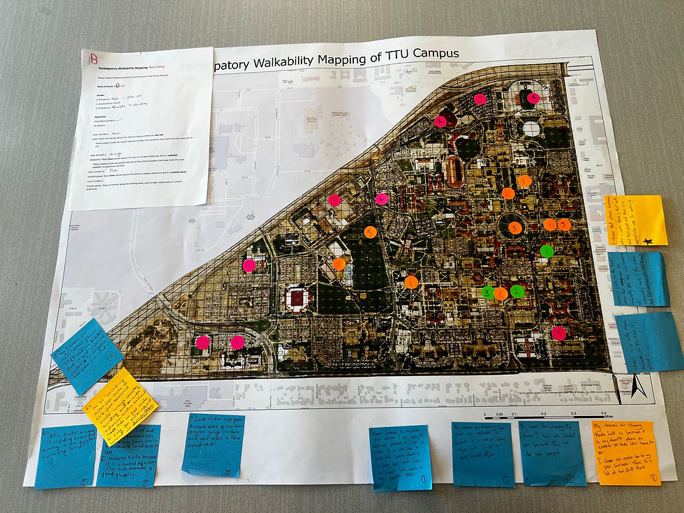


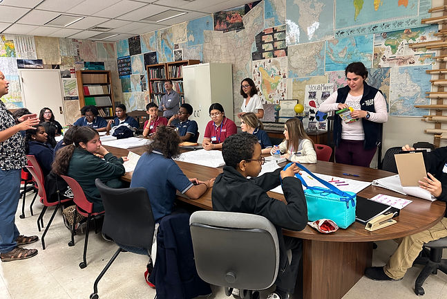
Spring 2024 |Participatory Campus Walkability Mapping
Featured in:
https://youtu.be/NAP845HsEA4?si=W2YCy63g4-0-TXie
This project combined geospatial technology, manual mapping, and participatory methods to assess campus walkability. Students first completed individual walking diaries using ArcGIS Field Maps to record GPS trajectories and Survey123 to log observations about safe, unsafe, or obstructed areas.
In the collective mapping phase, participants created manual sketch maps to identify places they felt were walkable, isolated, or interesting/notable. These maps were later digitized into GIS for analysis.
The results were synthesized into color-coded maps:
-
Green areas = safe and walkable
-
Orange areas = isolated
-
Red areas = interesting or notable
By integrating digital trajectories, qualitative Survey123 responses, and collective sketch maps, the study revealed both the physical structure of campus pathways and the social/emotional perceptions of walkability. These findings provide evidence-based insights for planning safer, healthier, and more inclusive campus environments.

Engaged Research
Workshop
Spring 2025 |
https://www.arch.tamu.edu/erw/
During a series of presentations on engagement and research, audience members formed small groups to capture ideas they found intriguing, memorable, and worth pursuing.
One phrase that stayed with me was: “what is worth working on.” Guided by this question, our breakout sessions focused on brainstorming research initiatives for 2025, identifying opportunities, barriers, and solutions that could drive meaningful community impact.